More Than Drone Pilots. We Are Your Aerial Data Partners.

Headquartered in Houston, Texas, we deploy top-tier UAV hardware and processing workflows across the Gulf Coast, Southwest, and Midwest. We don't just fly drones; we deliver verifiable data formatted for your specific workflow.

Partner With Us

Built for Surveyors, Engineers, and Innovators

Let us be your partner in breaking the barrier to entry for high-quality aerial data. No huge capital invesment and months of specialized flight and processing training.

We built this company to bridge the gap. By acting as your outsourced drone department, you get immediate access to top-tier hardware—like the Quantum Systems Trinity Pro and YellowScan Qube240—without the overhead.
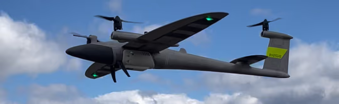
Quantum Systems Trinity Pro eVTOL drone taking off with YellowScan Qube240 Lidar sensor for aerial mapping

Based in Texas. Deployed Nationwide.

Headquartered in Houston, Texas, Turner Drones deploys top-teir aerial data collection across the contiguous United States. We optimize our mobilization rates based on three operational tiers, outlined in the map here:
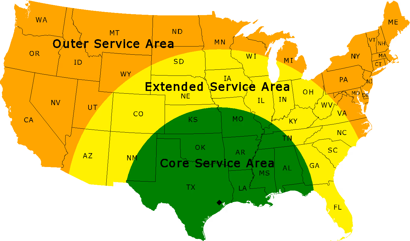
  • Core Service Area (685-Mile Radius): Rapid deployment across all of Texas, Oklahoma, Arkansas, Louisiana, Mississippi, and Alabama, plus regional coverage extending into NM, CO, KS, MO, IL, KY, TN, GA, and the FL Panhandle.
  • Extended Service Area (1,100-Mile Radius): Routine mobilization expanding outward across the Midwest, Southeast, and Southwest, including AZ, UT, WY, SD, MN, WI, MI, OH, WV, VA, NC, SC, IN, IA, and NE.
  • Outer Service Area (Contiguous US): Nationwide availability for large-acreage, high-value enterprise contracts across the lower 48 states.
Request a Deployment Estimate
Map showing Turner Drones nationwide UAV lidar and aerial mapping service areas originating from Houston, Texas.

Ready to expand your firm's capabilities?

Let us handle the airspace and data processing.